Mobile 3D Maps
Problem description
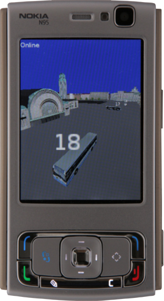
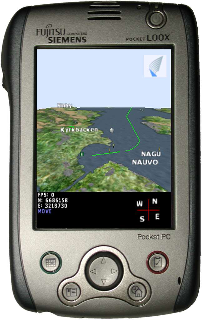
Consider the Earth, accessible from you mobile phone as a realistic, one to one mapped virtual environment. The environment can be populated with static location based information, but with networking, the system can also support dynamic data, such as location based discussions or visualizations of near real time measured data. All services or annotations associated to any visible object are directly available from the 3D view. Given networking and near real time message passing, the mobile planet can be alive, portraying your friends, public transportation or anything carrying a tracking device and allowing itself to be tracked. The planet provides a spatial context to all information it encompasses.
The mobile planet does not exist yet, and desktop 3D environments such as Google Earth cannot be simply ported to mobile platforms. The first challenge is technical: how can such as system be brought into existence? We have attacked this problem in two previous projects, Tellmaris and m-LOMA, but a definite system is yet be implemented. And if this would be possible, does this kind of an interface provide something no other interface can? We address the issue constructively, by implementing and testing with users.
 |
 |
Research questions
The era of virtual reality hype in the 90's leveraged a hectic development of virtual environments on the web. However, the web never became a 3D space, and the various VRML models soon disappeared. At the same time, 3D games became a huge industry. What went wrong? Google Earth has already proved that the fundamental idea was feasible. We proceed in the track by developing technology, and advancing the user interface iteratively with field experiments.
1) Mobile 3D navigation interface. Navigation in 3D space is complex. With limited controls, what would be an optimal 3D navigation interface? Should the interface depend on the current navigation task? How dependent on auxiliary devices such as GPS the system is?
2) Visualization and modeling. Is a realistic 3D visualization the best possible for a mobile user, or is it sufficient to provide crisp cues against a simple 3D background? Should the visualization depend on the current navigation task? What is the required level of detail? How to overcome the keyhole property of the small display? How to present external data, such as measurements, over the 3D view? How can appropriate 3D models be created in large scale?
3) Functionalities. In addition to a navigation interface, what added value does a 3D reprensetation provide to the user as a location based dynamic interface?
The track will engage the whole range of problems related to dynamic 3D maps from technology to the user experience. The track will produce prototypes and involve users in focused field experiments and simpler iterative trials.
The track touches related problems of mobile mixed reality and augmented maps.
Contact
Contact person: Antti Nurminen, andy@cs.hut.fi
Projects
The project is currently progressed in Hydrosys, starting 1.6.2008. Related work is done in IPCity for the development of a MapLense application.
Publications
Nurminen A. and Helin V., Technical Challenges in Mobile Real-Time 3D City Maps with Dynamic Content, Proceedings of IAESTED Software Engineering, Innsbruck, Austria 2005.
Oulasvirta, A., Nivala, A-M., Tikka, V., Liikkanen, L., and Nurminen, A. Understanding Users' Strategies with Mobile Maps. Mobile HCI 2005, Workshop on mobile maps.
Nurminen, A. m-LOMA - a Mobile 3D City Map. ACM Web3D'06.
Nurminen, A. m-LOMA - a Mobile 3D Portal to Location-based Informatio. Eurographics 2006.
Nurminen, A. A Platform for Mobile 3D Map Navigation Development. Mobile HCI 2006.
Nurminen, A. Mobile, hardware-accelerated urban 3D maps in 3G networks. ACM Web3D '07.
Nurminen, A. and Oulasvirta, A. Designing Navigation in 3D Mobile Maps. In Meng, L., Zipf, A. and Winter, S. (eds.) Map-based Mobile Services. 2008. Springer.
Nurminen, A. Managing dynamic entities in mobile, urban virtual environments. Journal of WSCG, 2008.
(to appear) Oulasvirta, A., Estlander, S. and Nurminen, A. User Strategies in Locating Objects with a 3D versus 2D Mobile Map. Personal and Ubiquitous Computing, 2008.
(to appear) Nurminen, A. Mobile 3D Maps. IEEE Computer Graphics and Applications, July-August 2008.
Last updated on 9 Dec 2008 by WWW administrator - Page created on 3 Apr 2008 by Teemu Mäntylä